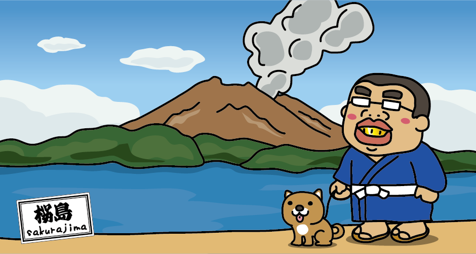
Sakurajima
Things to know before traveling! Professor Rabbit will introduce you to the basics of sightseeing in Sakurajima!
Sakurajima, floating in Kinko Bay (Kagoshima Bay) in Kagoshima Prefecture, is a volcanic island with an altitude of 1117 m, an area of about 80 km², and a circumference of about 52 km. It used to be an “island”, but in 1914 (Taisho 3) it was connected to the Osumi Peninsula by lava flowed out by a large-scale eruption. Even now, it is an active volcano that repeats small eruptions almost every day, but the four cities of Kagoshima, Kirishima, Tarumizu, and Aira at the foot of the mountain and on the opposite shore are about 820,000, or about 54% of the mainland population of Kagoshima Prefecture. It is a rare area in the world where people live and an active volcano and a city are adjacent.
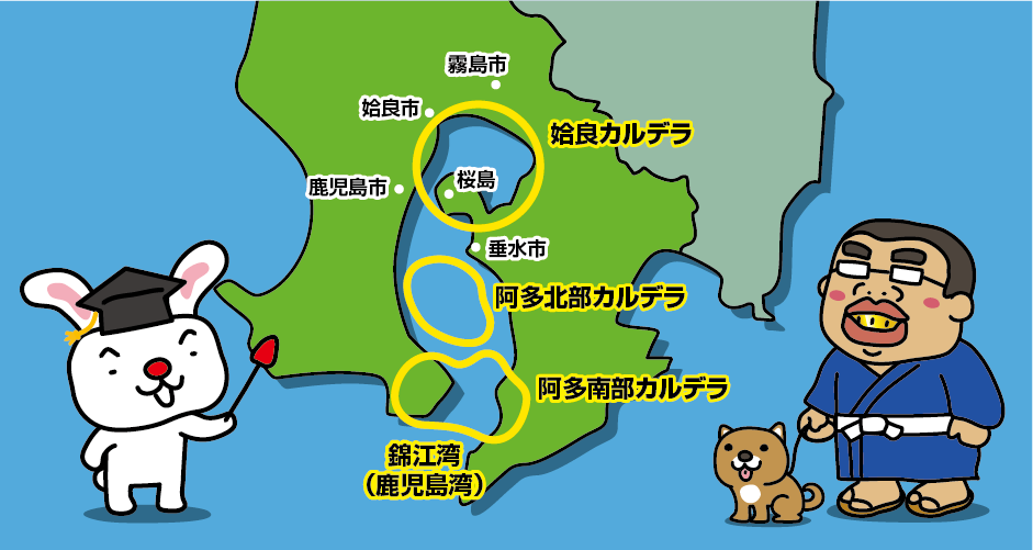
Kinko Bay is a caldera sea formed by volcanic eruptions and tectonic movements. A caldera is a large depression created by volcanic activity. It is thought that the entrance to Kinko Bay was formed by the eruption and sinking of the Ata Caldera at the mouth of the bay about 105,000 years ago, and the Aira Caldera at the back of the bay was formed by the eruption and sinking about 29,000 years ago, thus forming the current shape of Kinko Bay.
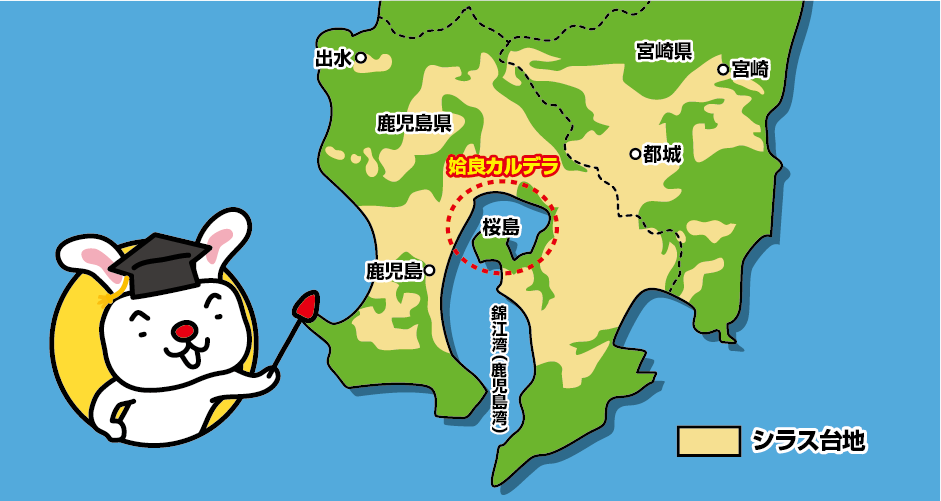
About 60% of the mainland area of Kagoshima Prefecture is covered with shirasu. Shirasu means white sand, and is the accumulation of pyroclastic flows, pumice stones, and volcanic ash that flew into the air during eruptions. It is often confused with volcanic ash from the Sakurajima’s eruption, but most of Shirasu is sediment from the pyroclastic flow when the Aira Caldera was formed 29,000 years ago.
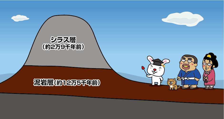
Shirasu deposited over a wide area reaches a thickness of 100m in some places. Most of them form flat plateaus, so they are called “Shirasu Daichi (Shirasu Plateau)” in school textbooks. It is thought that after being covered by pyroclastic flows and becoming a plateau of the same height, it was eroded by the action of flowing water such as rivers and heavy rains, resulting in the current topography.
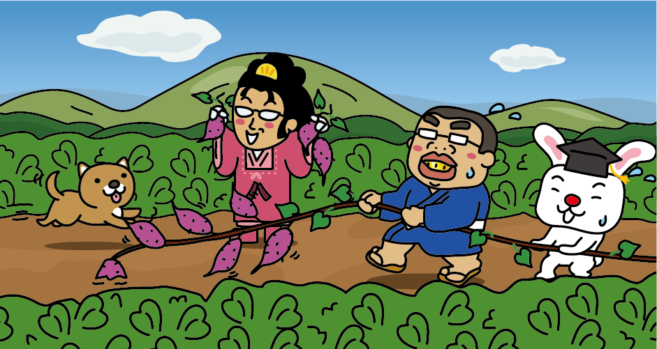
Shirasu has poor water retention and the soil is poor, so sweet potatoes are often cultivated on the Shirasu plateau in Kagoshima Prefecture. Sweet potatoes don’t need fertilizer. If the fertilizer is too effective, only the leaves will grow thick and the sweet potatoes will not grow. The Shirasu plateau is suitable soil for sweet potato cultivation.
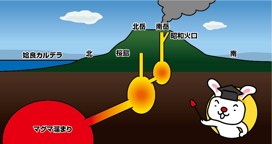
Sakurajima is a volcanic island formed at the southern tip of the Aira Caldera about 26,000 years ago. Around 10km below the seafloor of the Aira Caldera, it is believed that there is a magma chamber that continues to be active even today, and Sakurajima has had 17 major eruptions to date. Of these, three large eruptions have been recorded in the last 1,000 years. 1471, 1779 and 1914.
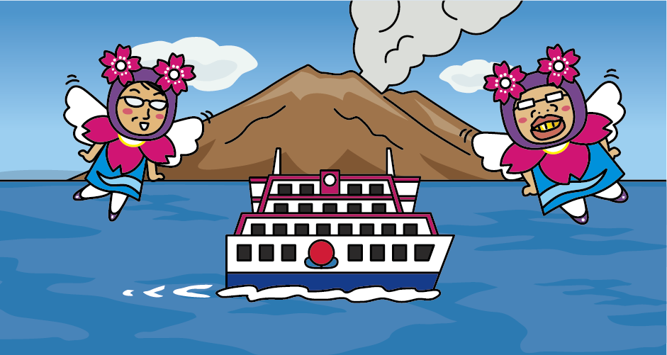
The 24-hour car ferry that connects Kagoshima Port and Sakurajima in 15 minutes departs and arrives at intervals of at minimum 15 minutes.
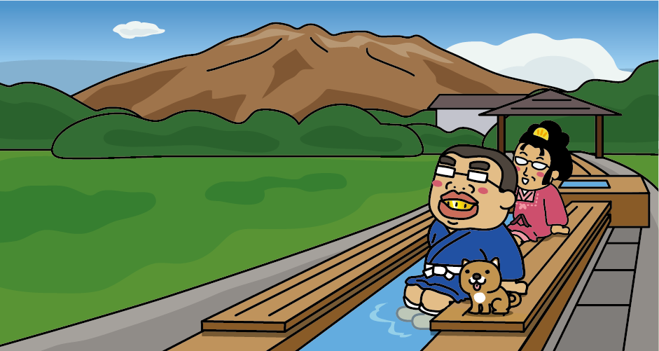
Yogan Nagisa Park is a 10-minute walk from Sakurajima Port. In the park, there is one of the largest free footbaths in Japan with a total length of about 100m.
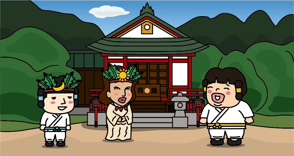
Tsukuyomi Shrine, which is located near Sakurajima Port, enshrines Tsukuyomi no Mikoto, the younger brother of Amaterasu Omikami. The shrine retains the legend that Tsukuyomi no Mikoto, the god of the moon and agriculture, was born on Sakurajima.
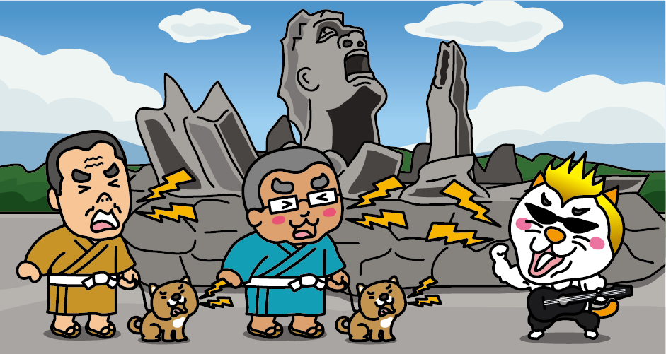
At the Akamizu Observation Square, there is a monument called “Portrait of a Scream,” created using 50 tons of Sakurajima’s lava to commemorate Tsuyoshi Nagabuchi’s “Sakurajima All Night Concert” held on August 21 and 22, 2004.
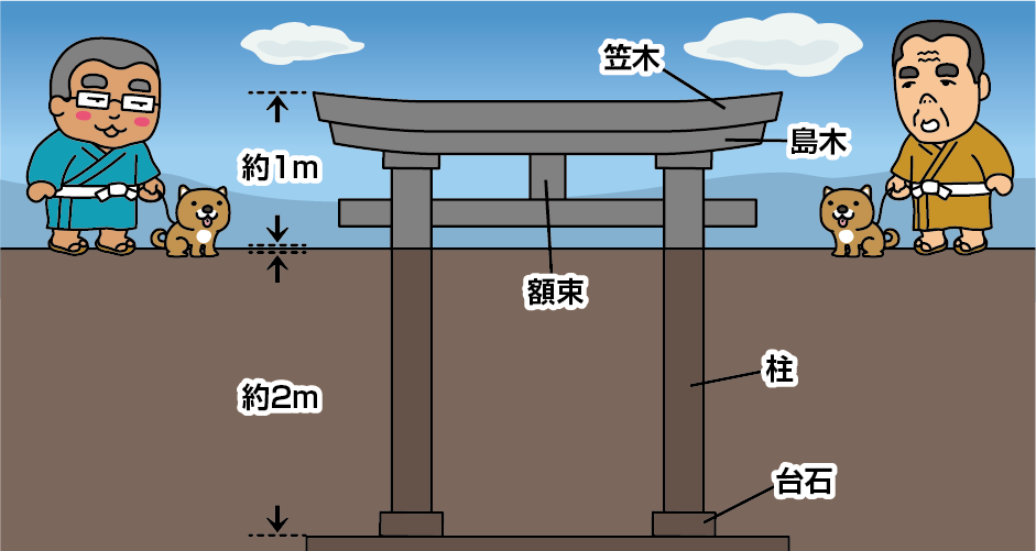
In the 1914 (Taisho 3) huge eruption, the torii gate of Haragosha Shrine (Kurokami Shrine), which was 3m high, was buried in volcanic ash and pumice and became shorter than a person’s height. The Village mayor of Sakurajima at that time preserved it as it was in order to convey the threat of an eruption to future generations. This disaster heritage is called “Kurokami Maibotsu Torii” (Buried torii gate at Kurokami Shrine).
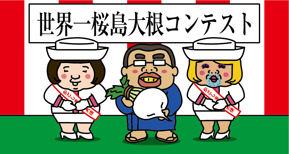
Sakurajima Daikon radish is a traditional vegetable of Kagoshima Prefecture, a specialty of Sakurajima, and is the world’s largest radish certified in the Guinness Book of Records. Normally shipped Sakurajima Daikon weighs around 6kg, but the world’s largest Sakurajima Daikon certified by the Guinness Book of Records has a girth of 119cm and weighs 31.1kg. At the end of January every year, Sakurajima Daikon radishes grown by producers all over Japan are lined up in Sakurajima. A Sakurajima Daikon Contest will be held with the aim of further Guinness Book certification while competing for the best Sakurajima Daikon radish.
Access to Sakurajima
[Airplane]
It takes about 1 hour and 45 minutes from Haneda Airport to Kagoshima Airport.
It takes about 1 hour and 10 minutes from Itami Airport to Kagoshima Airport.
It takes about 1 hour and 20 minutes from Kansai International Airport to Kagoshima Airport.
It takes about 50 minutes by airport bus from the Kagoshima airport bus stop to Kinseicho bus stop. About 15 minute-walk from Kinseicho bus stop to Kagoshima Port Sakurajima Ferry Terminal.
[Railway]
From Osaka
It takes about 4 hours from JR Shin-Osaka Station to JR Kagoshima Chuo Station by Sanyo/Kyushu Shinkansen.
From Fukuoka
It takes about 1 hour and 30 minutes from JR Hakata Station to JR Kagoshima Chuo Station by the Kyushu Shinkansen.
It takes about 15 minutes from the bus stop at JR Kagoshima Chuo Station to the bus stop in front of the aquarium. Near the Aquarium bus stop.
About 15 minutes from Sakurajima Port Ferry Terminal to Sakurajima Port Ferry Terminal. Sakurajima Ferry operates 102 flights on weekdays and 112 flights on weekends and holidays.


You need to login to comment on an article.