We were able to climb Betabumizaka of Eshima Ohashi Bridge without stepping on the accelerator pedal fully! Also, the brakes worked downhill!
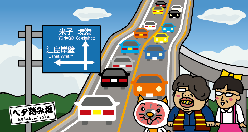
Eshima Ohashi Bridge (1.7 km in length) is a bridge between Sakaiminato City, Tottori Prefecture, and Eshima Island of Matsue City, Shimane Prefecture. The height of the bridge girder is 45 m from the lake surface at its highest, and with the help of optical illusions, it looks like a steep slope from the Shimane Prefecture (Eshima Island) side. It was also introduced by a car manufacturer TV Commercial as if the slope can only be climbed with the accelerator pedal fully open, getting famous as “Betabumizaka.” It is 10 minutes by car from “Mizuki Shigeru Road” in Sakaiminato City, Tottori Prefecture.
The reason why Eshima Ohashi Bridge became like a slope
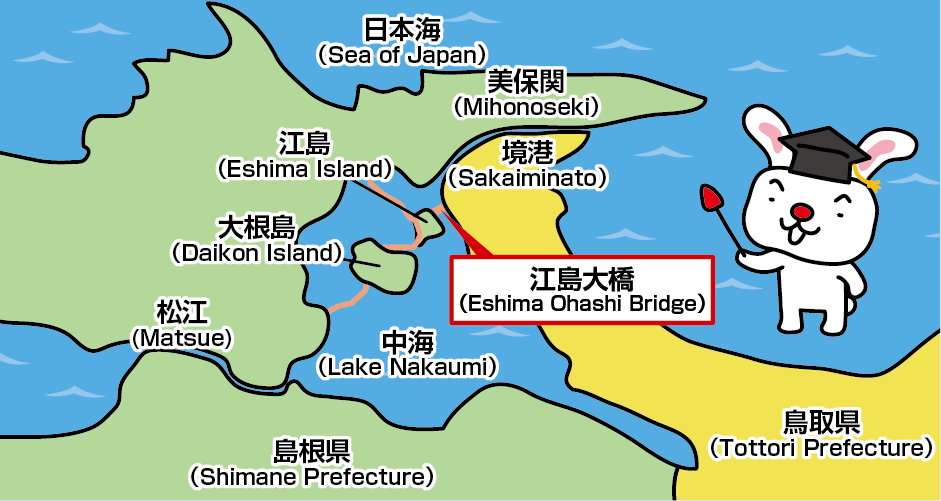
The reason why Eshima Ohashi Bridge became so steep is that the girdle had to be high enough so that 5000t ships sailing within “Nakaumi,” a brackish lake, could safely go under the bridge. Until 2004, before the construction of Eshima Ohashi Bridge, there was the “Nakaura Sluice Bridge,” a drawbridge that opened whenever a ship passed through. It was inconvenient because it blocked the road every time a ship passed through, and also because large trucks were unable to pass because of weight restrictions. There is the unique episode of a sightseeing bus for “Yushien,” a Japanese garden on Daikonjima Island, connected to Eshima Island, which had to drop its passengers off at the bridge in order to pass its weight restriction. The passengers had to cross the bridge on foot.
6.1% gradient slope
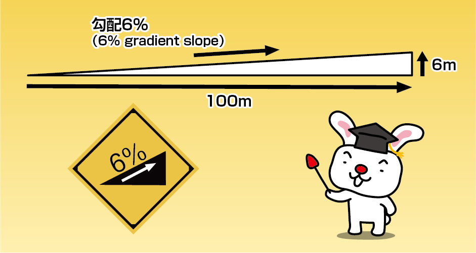
Eshima Ohashi Bridge (Betabumizaka) introduced in sightseeing pamphlets make the bridge look as if has a slope of 45 degrees, but it is actually a 6.1% gradient slope, which climbs 6m every 100m. It only has an angle of 3 to 4 degrees. Actually, it isn’t a steep slope at all. This calculation can be solved from trigonometry (tangent) taught in high school. By the way, a slope of 45 degrees is 100% gradient, and the steepest slope of Tottori Sand Dunes, Umanose, has 32 degrees.
Recommended photo spot of Eshima Ohashi Bridge
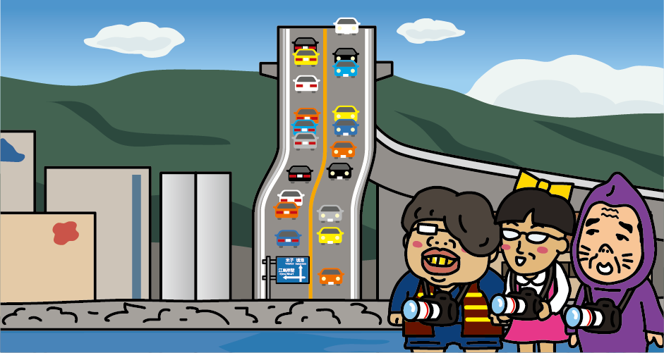
Many tourists look from the convenience store nearby Eshima Ohashi Bridge, but if you want to take a photo of “Betabumizaka” like the sightseeing pamphlets, we recommend you go to the other side of Eshima Island to Daikonjima Island. If you shoot from Daikon Island using the camera’s zoom function, the scenery will be compressed and you can shoot a steeper slope than it actually is. You can’t get the illusion effect just by shooting with a smartphone camera, so you can’t shoot the steep “Betabumizaka”.
Access to Eshima Ohashi Bridge
[Railway]
From Osaka
It takes about 45 minutes from JR Shin-Osaka Station to JR Okayama Station by Sanyo Shinkansen.
From Fukuoka
It takes about 1 hour and 45 minutes from JR Hakata Station to JR Okayama Station by Sanyo Shinkansen.
From JR Okayama Station, transfer to the JR Sanyo Main Line (limited express) to JR Yonago Station in about 2 hours 15 minutes. Transfer to the JR Sakai Line at JR Yonago Station and get to JR Sakaiminato Station in about 50 minutes. Get off at JR Sakaiminato Station and take a taxi to Eshima Ohashi Bridge in about 15 minutes.
[Airplane]
From Tokyo
It takes about 1 hour and 20 minutes from Haneda Airport to Yonago Airport. It takes about 15 minutes by taxi from Yonago Airport.
From Osaka
It takes about 50 minutes from Itami Airport to Izumo Airport. It takes about 35 minutes from Izumo Airport to JR Matsue Station by airport shuttle bus. It takes about 35 minutes by taxi from JR Matsue Station to Eshima Ohashi Bridge.