Oyashirazu・Koshirazu Cliff
The world hardest road to go through! I visited the exceedingly steep cliff of Hokuriku “Oyashirazu” and felt a mother’s cry calling a child and child’s sob calling a mother!
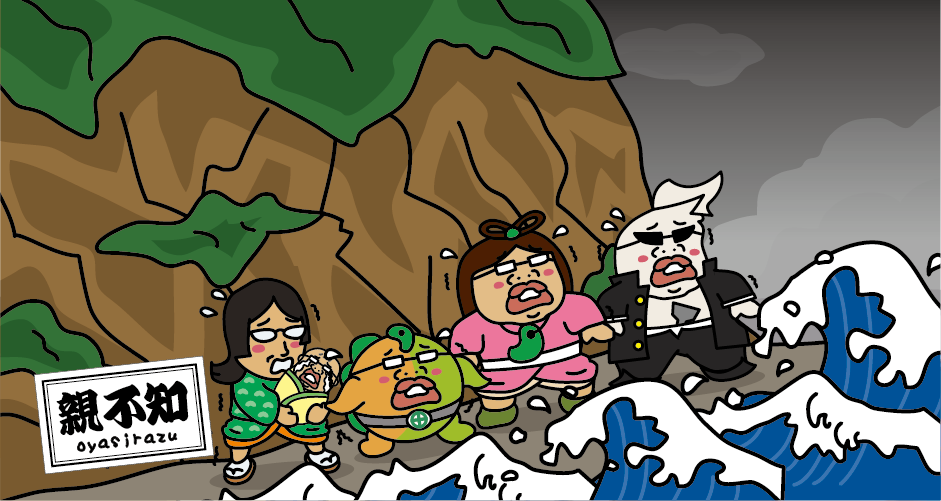
Oyashirazu is about 15km length of precipitous terrain where the cliff of Hida mountains (known as the North Alps) located at the western end of Itoigawa City, Niigata Prefecture. It is officially called “Oyashirazu・Koshirazu”. Near Oyashirazu・Koshirazu, the cliff of Hida mountains fall into the Sea of Japan directly and its steep geographical feature make it difficult to cross the mountains. So, in the old days, travelers come and go from Echigo (present Niigata Prefecture) and Etchu (present Toyama Prefecture) sometime evacuated to small caves of cliffs, walked beach that slightly remaining on the edge of water and passed the way between violent waves at the risk of their lives. Since there were not small number of people being carried off by waves, it was known as the most difficult choke point of Hokurikudo Road since long time ago.
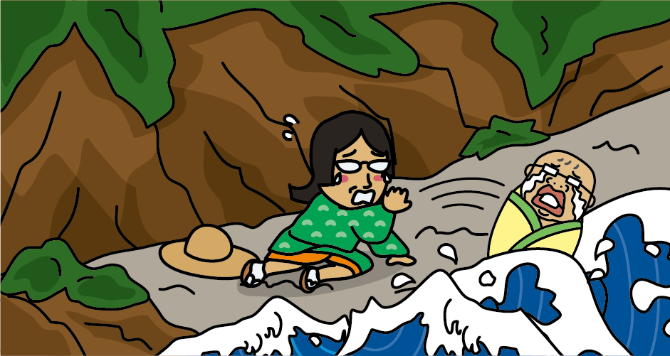
The name origin of “Oyashirazu・ Koshirazu” is that when people go through the edge of water, parents cannot take care about child and child also have to forget about parent to go through this choke point, so this place started to call as “Oyashirazu・Koshirazu”, everybody for himself in English. Also, in another story, when wife of Yorimori who was a younger brother of TAIRA no Kiyomori tried to go through this place to see her husband. On the way, her baby was taken away by the wave and she composed a poem about that sorrow and it still remaining. “Parent never knows, the child is sleeping in this bay, on the beach of Koshiji, gone like bubbles.” Koshiji is the old name of Hokurikudo Road.
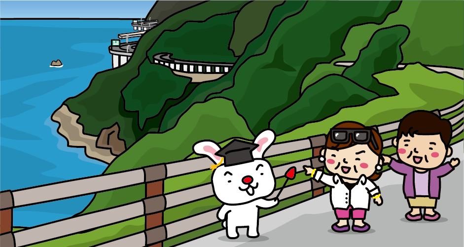
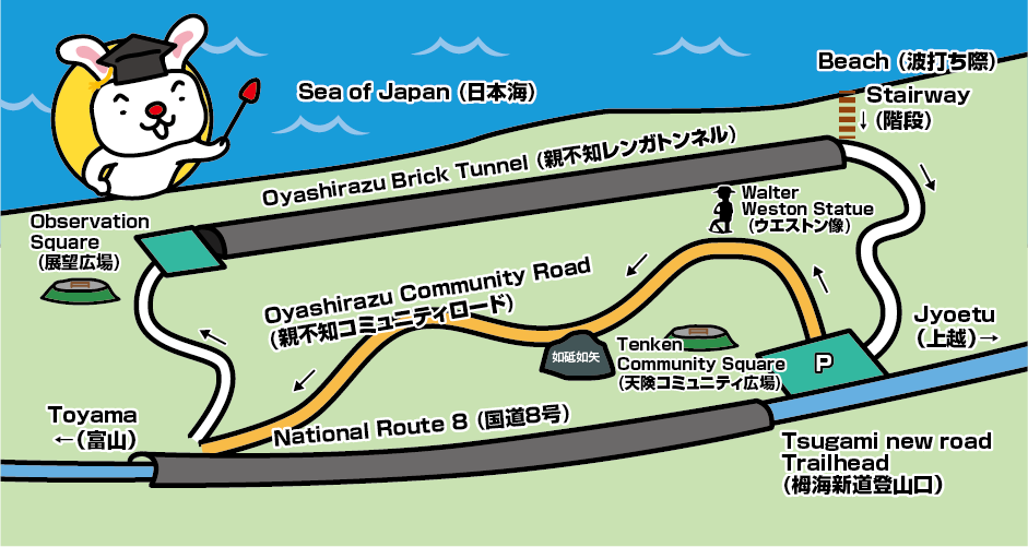
You can see four different generations of Hokurikudo Road from the observatory of Oyashirazu Community Road. Under your eyes, you can see the first generation’s water edge that is the name of “Oyashirazu・ Koshirazu” came from. It was used until around the beginning of Meiji Era. Now some sections are under the sea because of the beach erosion. The second generation is the former National Route which was opened in 1883 by cutting cliffs and now it is a promenade (City road, Tenken Oyashirazu Line) called “Oyashirazu Community Road”. The third generation is National Route 8. As the number of car increase, Tenken Tunnel opened in 1966 to accommodate two lanes in Tenken district of Oyashirazu. The fourth generation is Hokuriku Expressway opened in 1988. On the small flatland of Oyashirazu, National Route, prefectural road (former national Route) and railroad are packed tightly together and there’s no room to create new road, so Hokuriku Expressway passes over the sea. Also, maritime interchange was constructed first time in the world.
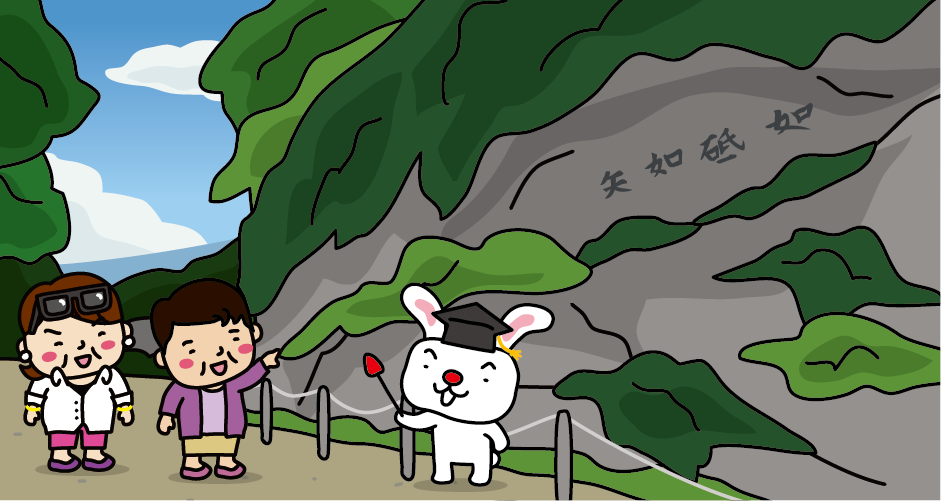
It is said that the excavation works of second generation, the former National Route 8 went through extreme hardship. Because its length was about 1 km but the bedrock of Tenken Oyashirazu was very hard, and also all works were done by human power. In 1883, as a commemoration of the completion of the road, letters of “Tono gotoku, Yamano gotoshi” were engraved on the surface of large rock. The meaning of this letters is that it praised the road as “smooth like grinding stone, straight like an arrow”.
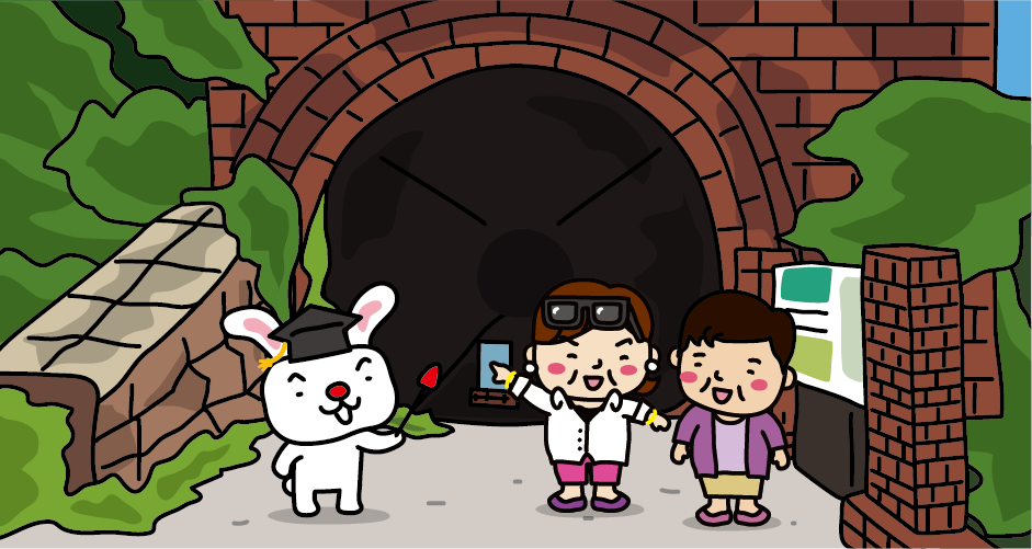
The former Oyashirazu Tunnel in former Hokuriku Main Line was completed in 1912 by going through the precipitous cliff of Tenken Oyashirazu which was the hardest choke point of Hokurikudo. It is a brick tunnel with a total length of about 670m. It was used for passenger transportation and also used as a transportation of limestones from Mt. Kurohime. After that, Hokuriku Main Line become the double line, it was discontinued in 1965.
Now, this tunnel can pass through, and “Former Oyashirazu Tunnel” and “Oyashirazu Community Road” are tour courses of 2km trip. The journey will take about 60 to 90minutes.
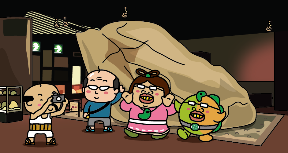
There is a road station “Oyashirazu Pier Park” that 2 minutes away by car from Hokuriku Expressway “Oyashirazu IC” that is the world first maritime interchange. At “Jade Furusato Center” at the road station, 102 tons of the world largest jade gemstone is displayed. It has very powerful appearance. Itoigawa City, Niigata Prefecture, where the Oyasirazu coast is located, is famous for producing jade.
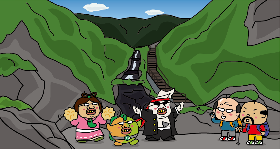
Tsugami new road is a mountain trail connecting the Sea of Japan and the North Alps. The water’s edge of Oyashirazu is the gateway but if you start climbing from near the coast, the total length will be about 27 km and altitude difference exceed 2,000m. It will take about 18 hours to climb and about 15 hours to climb down the mountain.
A bronze statue of Walter Weston, the English mountaineer who introduced Oyashirazu to the world as the starting point of the Japanese Alps, is located in the Oyashirazu Community Road.
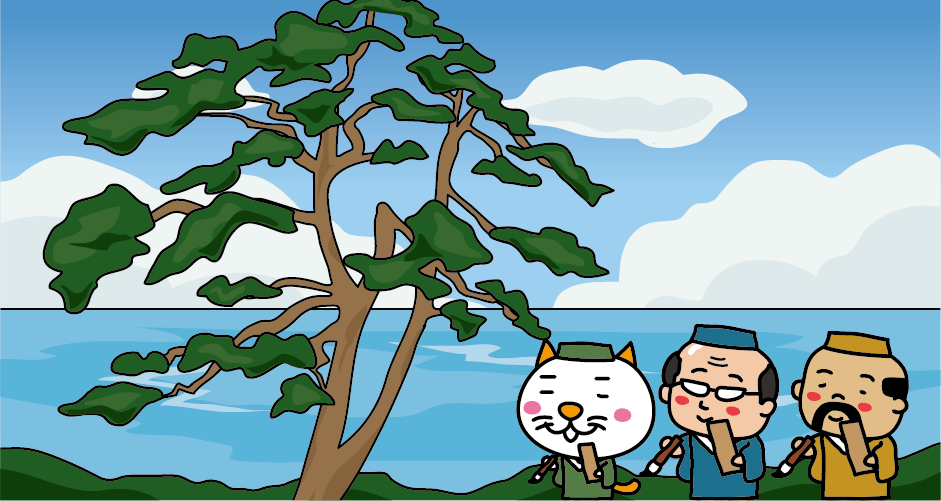
Ichiburi of Oyashirazu is a border village of Echigo and Etchu. It was flourished as a post-town of the west side of the former Hokurikudo’s choke point “Oyashirazu・Koshirazu” for a long time. In Edo era, Basho Matsuo also stopped at Ichiburi and composed a poem. “Under the same roof, a prostitute was sleeping too, the moon was shining on the bush clover.”
Also, there is an old pine called “Kaidou no matsu (pine of sea route)” of about 230 years old, and it was familiar to travelers as the mark of the start and goal of the choke point of Oyashirazu.
※This tree was fallen by typhoon in 2016. Now the pine tree with the same gene of Kaidou no matsu is planted.


You need to login to comment on an article.